CONSTRUCTION SITE MANAGEMENT
SURVEYING - AERIAL MAPPING
Introduction:
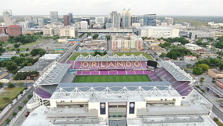
Our company supports leveraging aerial photography to enhance construction site management and mapping surveys. With advanced aerial imaging technology and experienced operators, we offer comprehensive solutions tailored to meet the unique needs of the construction industry. This capability statement highlights the key advantages and features of Aerial View Perceptions LLC services for construction site management and mapping surveys.
1. Site Monitoring and Progress Tracking
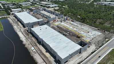
Our aerial photography services provide an invaluable tool for construction site monitoring and progress tracking. These aerial photographs enable stakeholders to monitor construction progress, identify potential issues, and make informed decisions based on real-time visual data.
2. Site Mapping and Surveying
Aerial View Perceptions LLC uses software (DroneDeploy) for aerial photography techniques to generate accurate and detailed site maps for construction projects.
3. Safety and Risk Assessment
Aerial View Perceptions LLC plays a crucial role in safety and risk assessment on construction sites. We can identify potential hazards, evaluate site accessibility, and monitor compliance with safety regulations. This enables proactive risk mitigation, ensuring a safer working environment for construction personnel and minimizing the occurrence of accidents or delays.
4. Communication and Reporting
Aerial View Perceptions LLC services facilitate effective communication and reporting among project stakeholders. We provide visual documentation, including annotated aerial images, that clearly communicate construction progress, site conditions, and project milestones. This visual data helps stakeholders visualize and understand the status of the project, fostering collaboration, and streamlining decision-making processes.
5. Project Documentation and Marketing
Our high-quality aerial images capture the scale, scope, and architectural details of construction projects, which can be used for documentation, presentations, and marketing materials. These visually compelling photographs enhance project portfolios, attract potential clients, and showcase completed projects in their full glory.
6. Customized Solutions and Flexibility
We understand that each construction project is unique, and we offer customized solutions to meet specific requirements. Our experienced team collaborates closely with clients to understand their project goals, objectives, and constraints. We adapt our aerial photography techniques, flight plans, and data analysis to suit individual project needs, ensuring accurate and relevant deliverables
Orthomosaic
Annotations Report
Elevation Data
Digital Terrain Model


Buildings and Structures